Monkton 1926
What Monkton looked like 100 years ago - The Centenary Trail
Change is all around us. I hope it’s possible to strip back the many recent changes in our village of Monkton (or Monocstun – the “Monks Land”) to reveal the fertile farming community of 100 years ago. My “Centenary Mile Walk of 1926” (download the map from the link below) will take you along that journey pointing out the small tied farm-cottages, the large houses, and the even larger farmhouses. Amongst them are the barns and sheds to store the harvest of hops, cherries, strawberries, apples, cucumbers, cauliflowers, arable crops and grazing land for sheep, cows, horses, (turkeys and chickens). As well as the big farms, there are the small holdings that were an important ingredient in feeding the village and exporting to other markets. If there isn’t a dwelling to see, then it was a barn, store, tree, bush, hedge or fence!
Try as I might to be accurate, I’m no expert, so I apologise, and welcome your personal knowledge to correct me. I’m always happy to talk about this project. The centenary walk is only Stage 1. I’m still collecting more stories from Monkton villagers about the life they lived here, and I hope it will be a fascinating insight for everyone, and a resource for future generations.
Stuart Horsburgh
Originally published in the Monkton News (September 2026).
Download the map
The four-page centenary walk map is also available as a single PDF: Download the Monkton 1926 map (PDF).
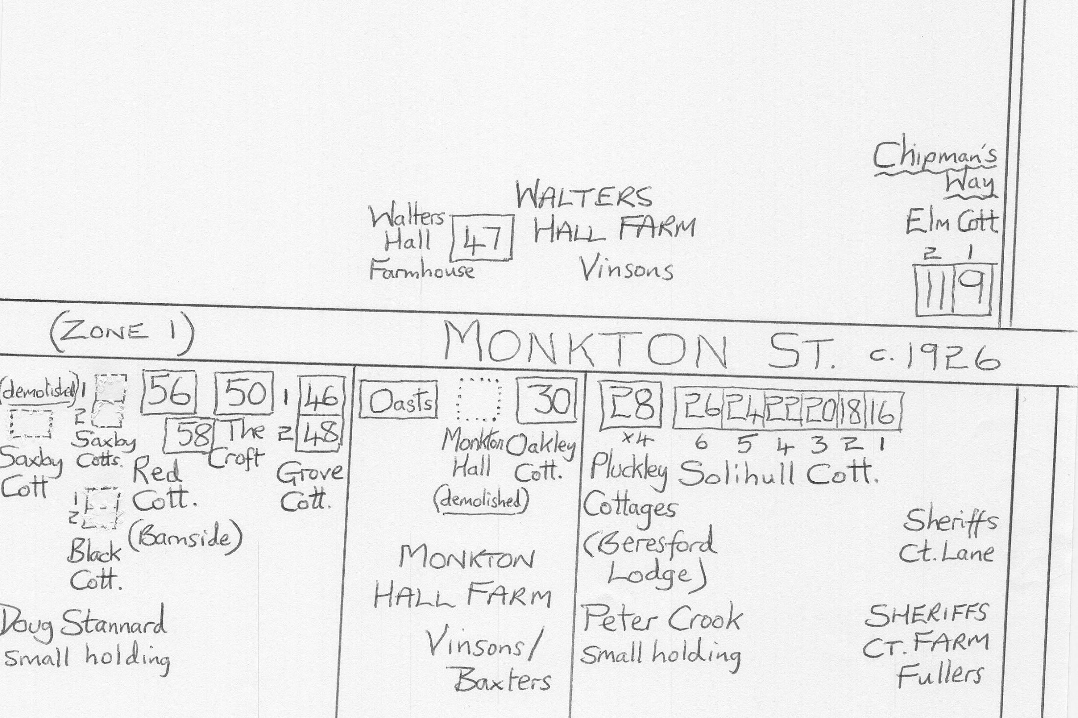
Zone 1
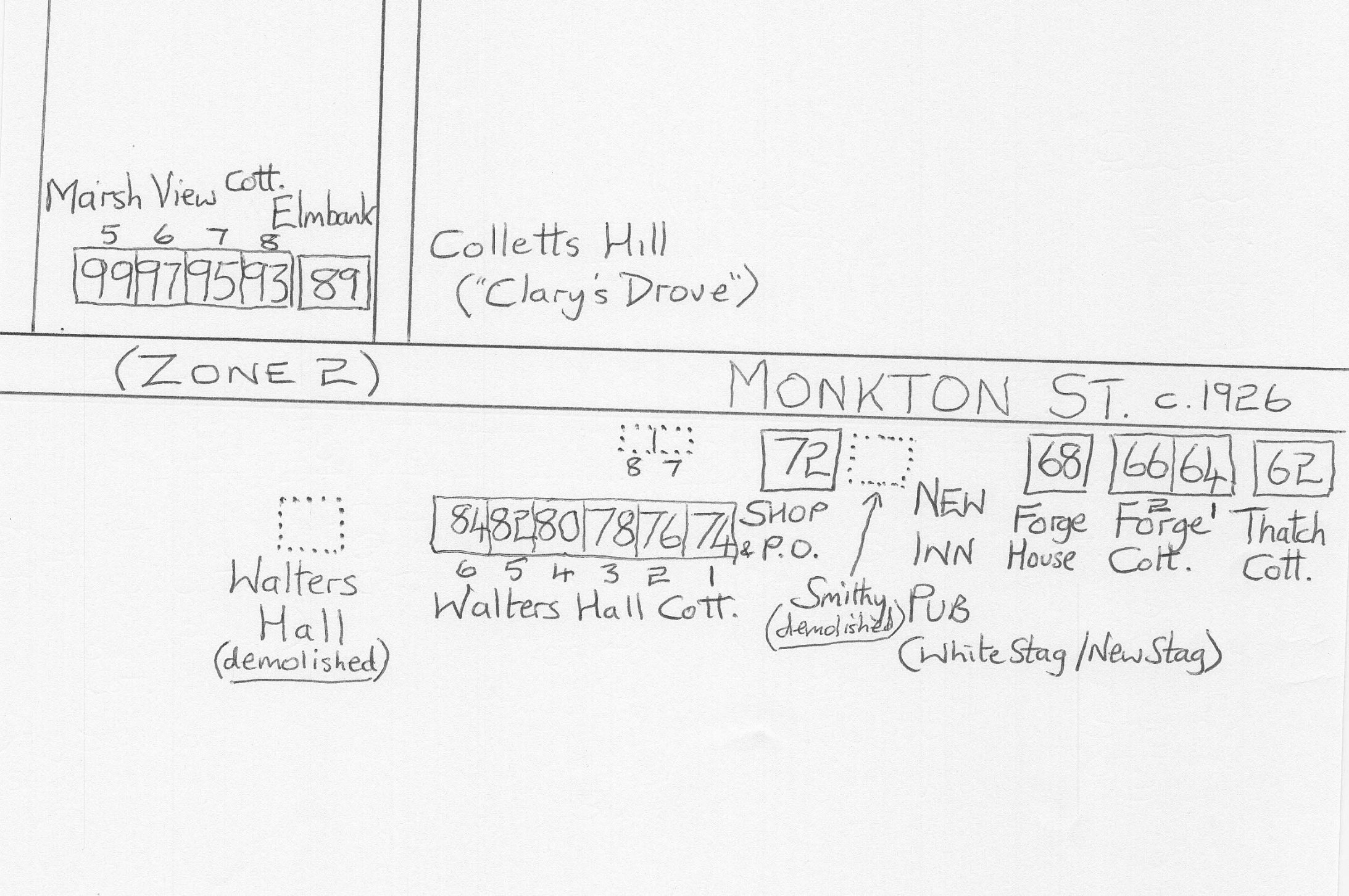
Zone 2
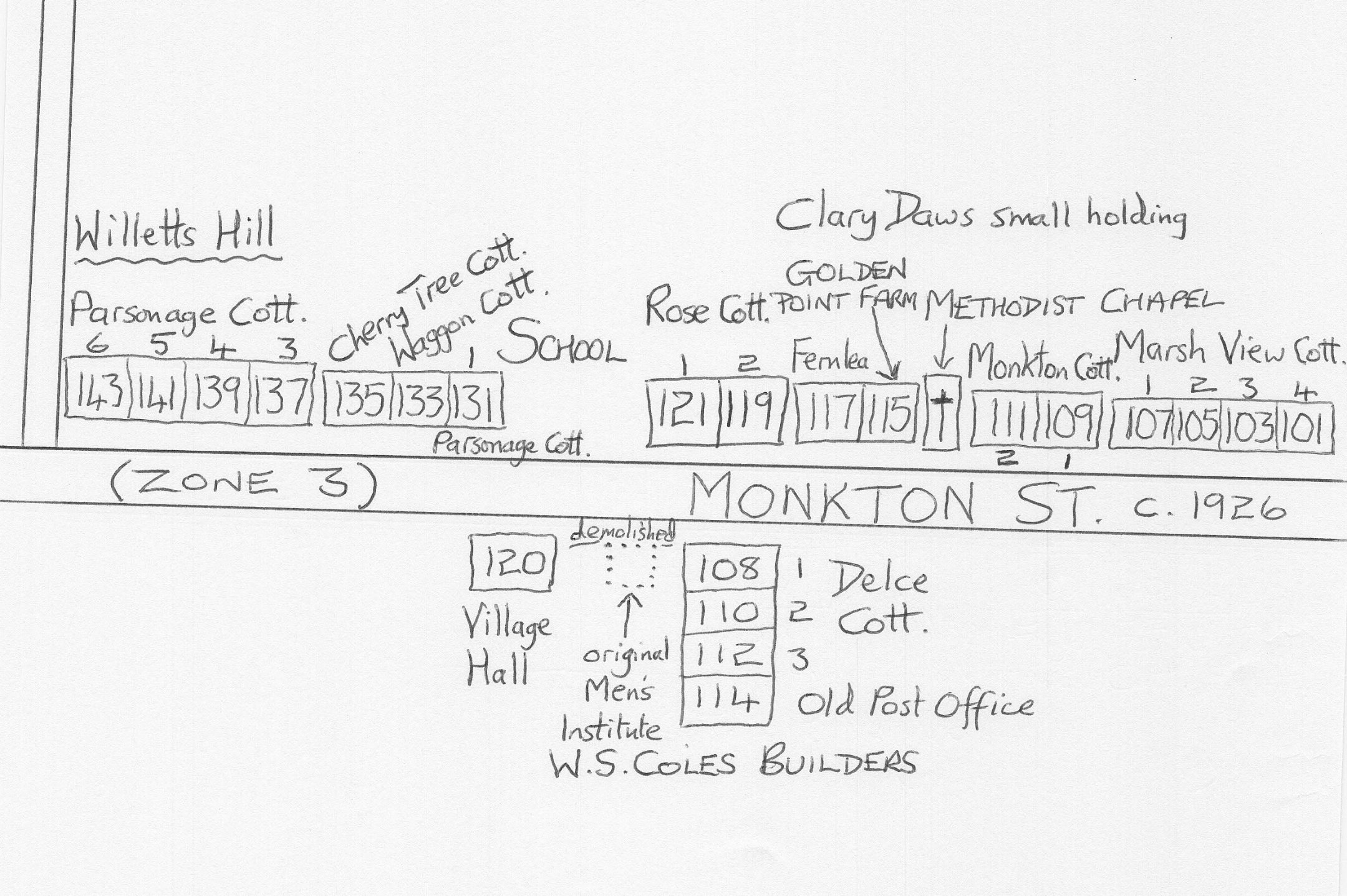
Zone 3
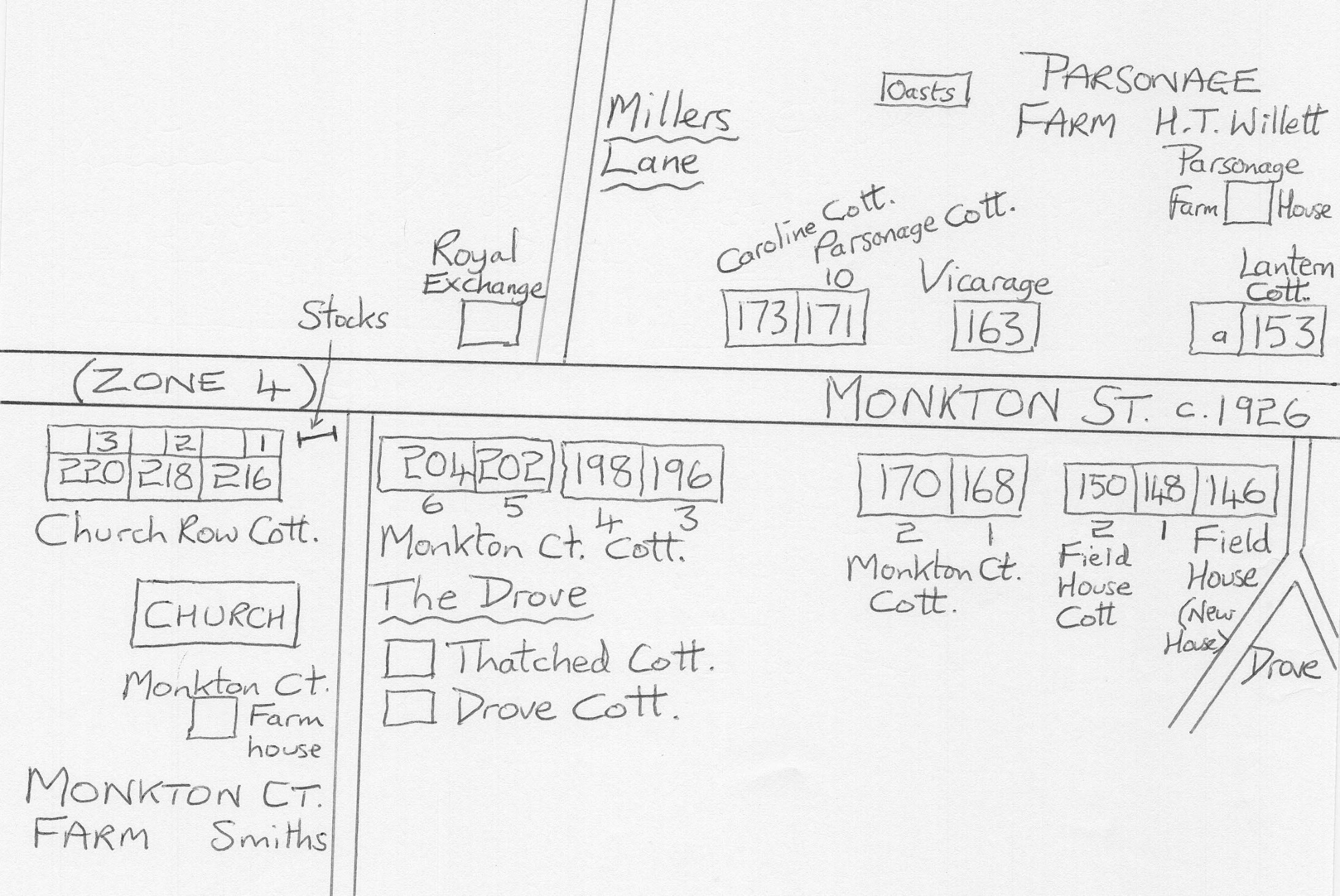
Zone 4